
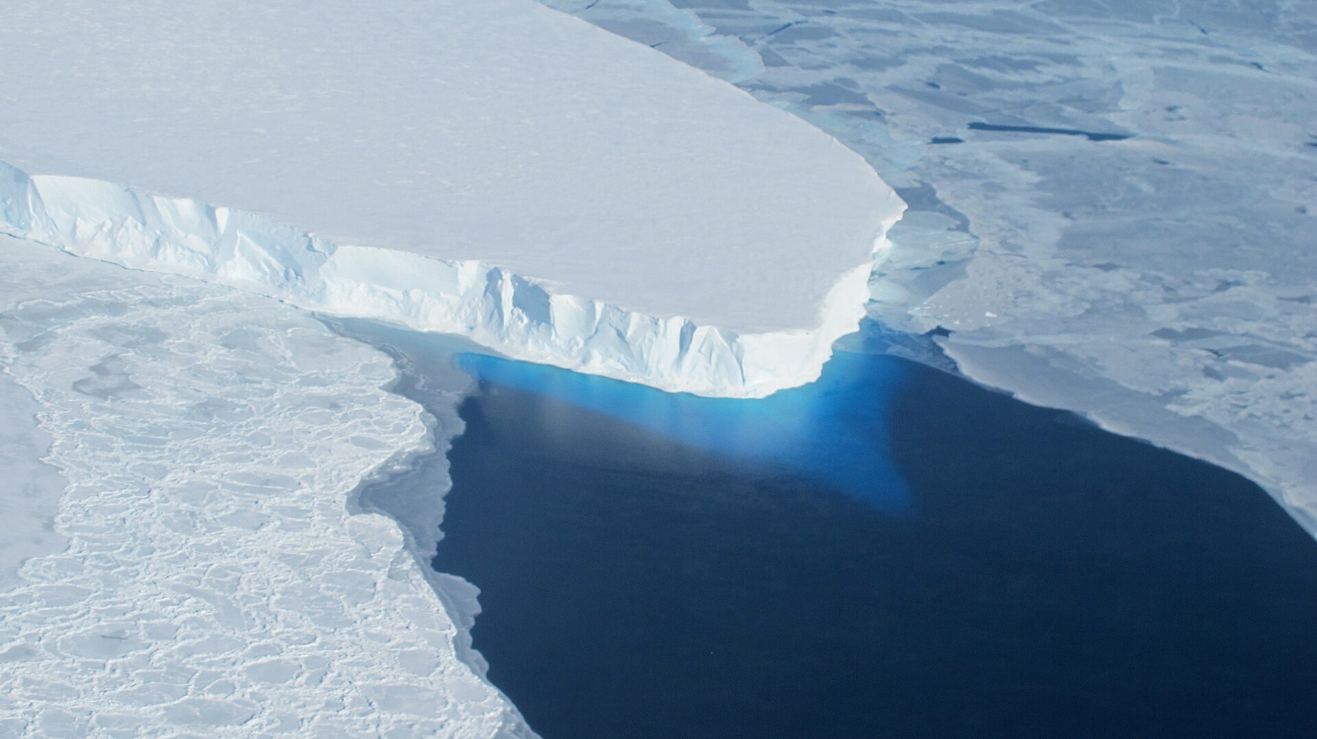
Often referred to as the ‘Doomsday Glacier’ (although the nickname is much contested by scientists), the Thwaites Glacier is the widest glacier on Earth at a whopping 120km, covering an area of 192,000 km2 – larger than the entire US state of Florida by around 20,000 km2.
- Why scientists just drilled 1,000m to the bottom of the ‘Doomsday Glacier’
- Scientists resurrect 40,000-year-old organisms from Arctic ice – now they’re worried
The Thwaites Glacier is located in the Amundsen Sea Embayment sector of West Antarctica, which accounts for one third of the mass loss from the Antarctic Ice Sheet. According to a 2019 study, the glacier itself is responsible for around 4 per cent of all global sea-level rise.
This glacier owes its morbid moniker to the alarming rate at which it is melting – and according to new research, that rate might have been underestimated. Scientists from the University of California Irvine (UC Irvine) and NASA’s Jet Propulsion Laboratory have now developed a new ice sheet model that projects this glacier will contribute up to 30mm of sea level rise by 2100, doubling the previous estimates. And that’s without additional climate warming.
Measuring ice loss
There are different methods to study ice sheets and measure their ice loss – one of them is by using computer models. For a long time now, glaciologists have based their assumptions on what they call a ‘grounding line’, a narrow and mostly stable line where ice leaves the land and begins floating on water.
But traditional models based on this assumption would often show slower movement than that detected with satellite observations, making future sea-level projections uncertain – especially when it comes to a significant glacier like Thwaites.
To investigate these discrepancies, the UC Irvine research team calibrated their ice sheet models against observations spanning more than 20 years. High-resolution satellite data from the US-Finnish ICEYE satellite constellation revealed kilometre-scale fluctuations in what is called the ‘grounding zone’, a broad area along the main trunk of the Thwaites Glacier where ocean water can reach beneath the glacier.
This means that the previous use of the ‘grounding line’ was significantly underestimating the processes going on underneath glaciers. The satellite data indicates that seawater penetrates several kilometres beneath grounded ice, lifting it during tidal cycles and flushing it with pressurised, warm seawater pushed to the Antarctic coastline by currents (such as the Antarctic Circumpolar Current) altered by climate change.
It’s exactly this process that is causing accelerated detachment of the Thwaites Glacier from stabilising ridges, leading to faster ice flow and deterioration.
“The Thwaites main trunk is being temporarily stabilised by the Mouginot Ridge. Once that ridge is unpinned, the glacier will continually retreat across a predominantly retrograde seafloor toward its next topographic high, the South Ridge,” says lead author Mattia Poinelli, a lecturer at UC Irvine and a research affiliate at the NASA Jet Propulsion Laboratory.
- East Antarctica recently gained almost 700 billion tonnes of ice – and scientists know why
- “They’re just waddling around in their poop.” Penguin poop is melting snow in Antarctica. Here’s how
The Mouginot Ridge is a kind of underwater hill, measuring a few kilometres high and located roughly 950m below sea level. According to Poinelli, simulations that factor in a 4–6-kilometre grounding zone predict a 60 per cent probability of unpinning this ridge by the end of the century. Simulations that omit the grounding zone, or make it too narrow, do not retreat beyond the Mouginot Ridge in the same timeframe.
“When you factor in key physical processes and calibrate against historical observations, you gain a reliable pathway for narrowing uncertainty in projections,” explains Poinelli.
“Most projections up-to-present have struggled to match the rapidity of the mass loss because of missing physics,” adds one of the study’s co-authors Eric Rignot, a UC Irvine professor.
“Our new model with more complete physics is able to match the record and then produces projections that are twice larger than before. These results predict greater risk of and exposure for coastal flooding than anticipated in the coming decades.”
Read the full findings in the journal Nature Communications.
Top image: a photo taken during a Korea Polar Research Institute expedition in 2026 shows icebergs calving at a steady pace from the front of Thwaites Glacier in West Antarctica. Credit: David and Denise Holland/New York University


