
Earth is estimated to be roughly 4.54 billion years old. Most of the rocks that formed while it was still young are long gone, recycled by the process of plate tectonics. However, some ancient rocks remain, serving as foundations for landscapes that support a variety of different plants and animals.
- Prehistoric Pompeii: "Truly astounding" fossil discovery in remote Moroccan mountains sheds new light on extinct animals
- “This place was just crazy rich with dinosaur footprints”. Scientists buzzing after huge prehistoric discovery in Alaska
The oldest landscapes on Earth typically lie atop rocks belonging to cratons. These are thick, buoyant blocks of continental crust anchored deep in the Earth’s molten interior that have resisted geological deformation for billions of years. As highly stable pieces of crust, cratons often act as the rigid structural cores upon which continents form.
While the surfaces of these cratons - what we’d typically refer to as ‘landscapes’ - experience quite regular change, their roots can be traced back to periods of time when continents were only just beginning to form and life was very much in an experimental phase.
In other words, the characters in this stage play about life on Earth may change from year to year, millennium to millennium, but the backdrop remains very much the same.
Here are 10 landscapes that not only look ancient, but are built upon some of the oldest foundations our planet has ever known.
10 ancient landscapes you can still see today
Guiana Highlands
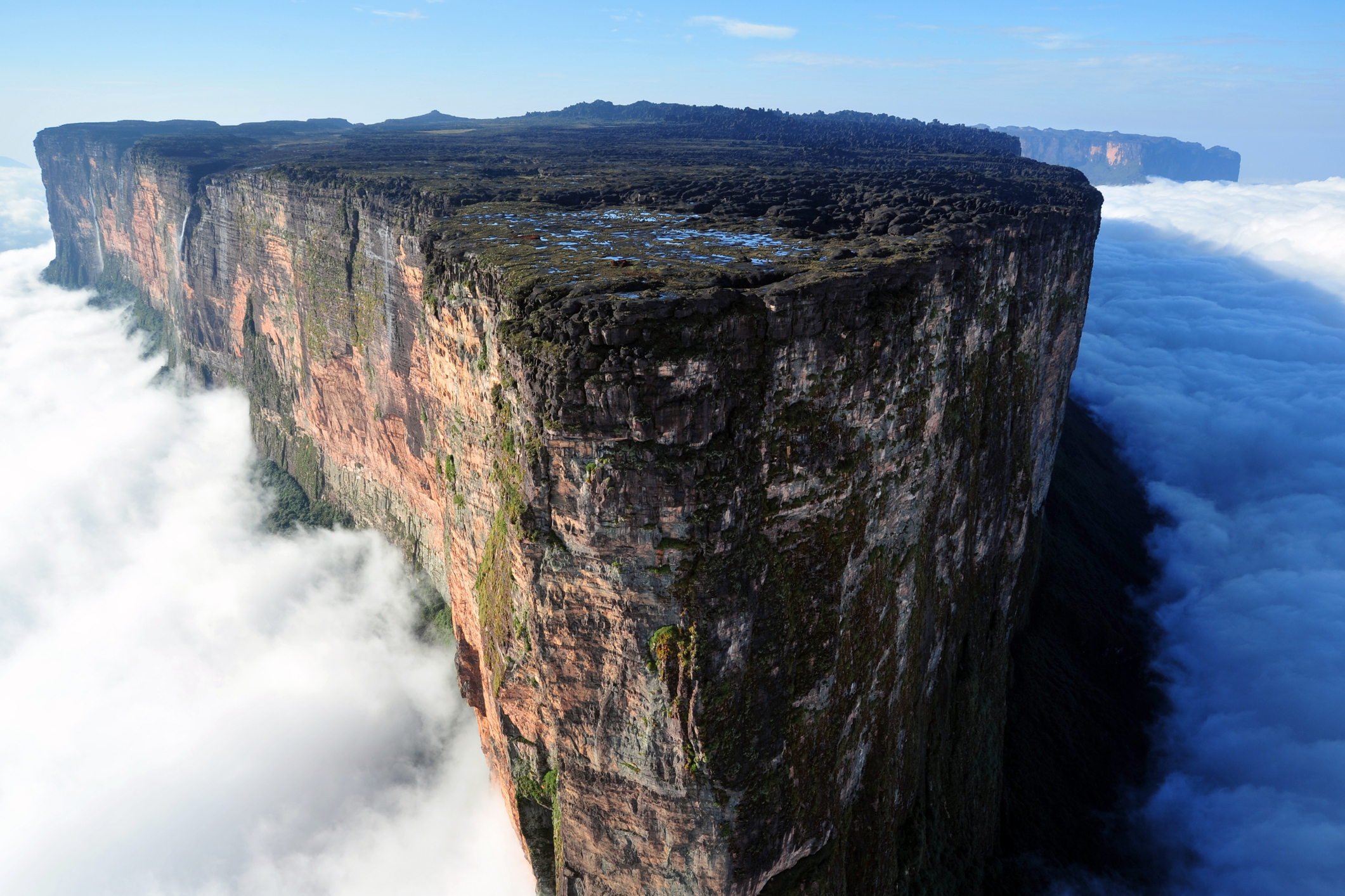
In northern South America, towering over the Amazon and Orinoco basins, are the two-billion-year-old Guiana Highlands.
This region spans southern Venezuela, northern Brazil, Guyana, Suriname, and French Guiana and is famous for its steep, table-topped mountains known as tepuis, which translate to ‘houses of the gods’ in the local Pemón language.
The world’s tallest uninterrupted waterfall, Angel Falls, cascades 979m off the edge of one of these tepuis, Auyán-tepui. While Auyán-tepui may be the largest tepui in the Guiana Highlands by land area, the title of highest goes to Mount Roraima, which sits above the clouds at an elevation of 2,810m.
The tepuis aren’t the only landmarks that make up this ancient landscape. This vast, rolling region is also covered in tropical rainforest and, in parts, drier savannah. These areas are home to more than 200 species of mammals, including jaguars, cougars, tapirs, and opossums, and nearly 650 species of birds.
Socotra Island
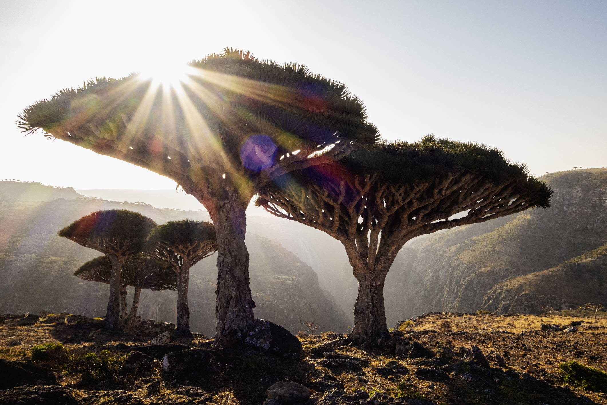
For the last 15 million years, Socotra Island has sat relatively undisturbed in the Indian Ocean, situated between the Gulf of Aden, the Guardafui Channel, and the Arabian Sea. Unlike other oceanic islands, which are typically formed by volcanic activity, Socotra Island is a ‘continental fragment’ that used to be part of the ancient African mainland.
As a result of detaching from the mainland and undergoing millions of years of isolation, the island functions somewhat like an ecological time capsule, preserving landscapes that no longer exist on the now-arid horn of Africa, over 1,000km away.
- Snake Island, Anthrax Island and beyond: 9 deadly Islands you'd be a fool to visit...
- "The rats went bananas." Here's what scientists say actually happened on Easter Island
It’s estimated that more than a third of Socotra Island’s plant life is endemic, meaning it’s found nowhere else in the wild. Dracaena cinnabari, the iconic dragon’s blood tree famous for its striking, umbrella-shaped canopy and crimson red sap, is just one of these endemic plants.
The island is also home to many different species of reptiles, 90% of which are endemic. This remarkable diversity of flora and fauna has earned Socotra Island and its three smaller associated islands (which make up the eponymously named Socotra Archipelago) the nickname ‘the Galápagos of the Indian Ocean’.
Negev Desert
The uppermost layer of Earth’s surface - the part visible to the naked eye - is continually evolving. On short timescales it may be buried by fresh sediment or volcanic debris; on longer timescales it can be pulled deep into Earth’s molten interior, where it’s melted and eventually recycled into new crust.
As a result, rocks exposed at Earth’s surface rarely persist for long, except in relatively tectonically inactive desert regions where rates of erosion and burial are low.
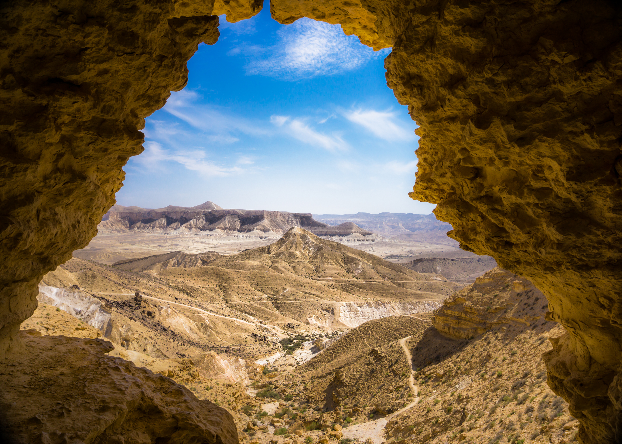
In 2009, researchers working in Israel’s Negev Desert found a vast ‘desert pavement’ that had been sitting there exposed and undisturbed for about 1.8 million years. According to the researchers involved, these kinds of ancient, undisturbed surfaces could be present in the Sahara Desert and the Arabian Desert too.
While it may be one of the driest regions on Earth, the Negev Desert hosts a surprisingly diverse ecosystem. Its rocky outcrops are home to Nubian ibex, as well as Dorcas gazelles, Arabian wolves, striped hyenas, caracals, and desert foxes. It’s also a hotspot for birds, supporting golden eagles, griffon vultures, hoopoes, and Asian houbaras.
Herodotus Basin
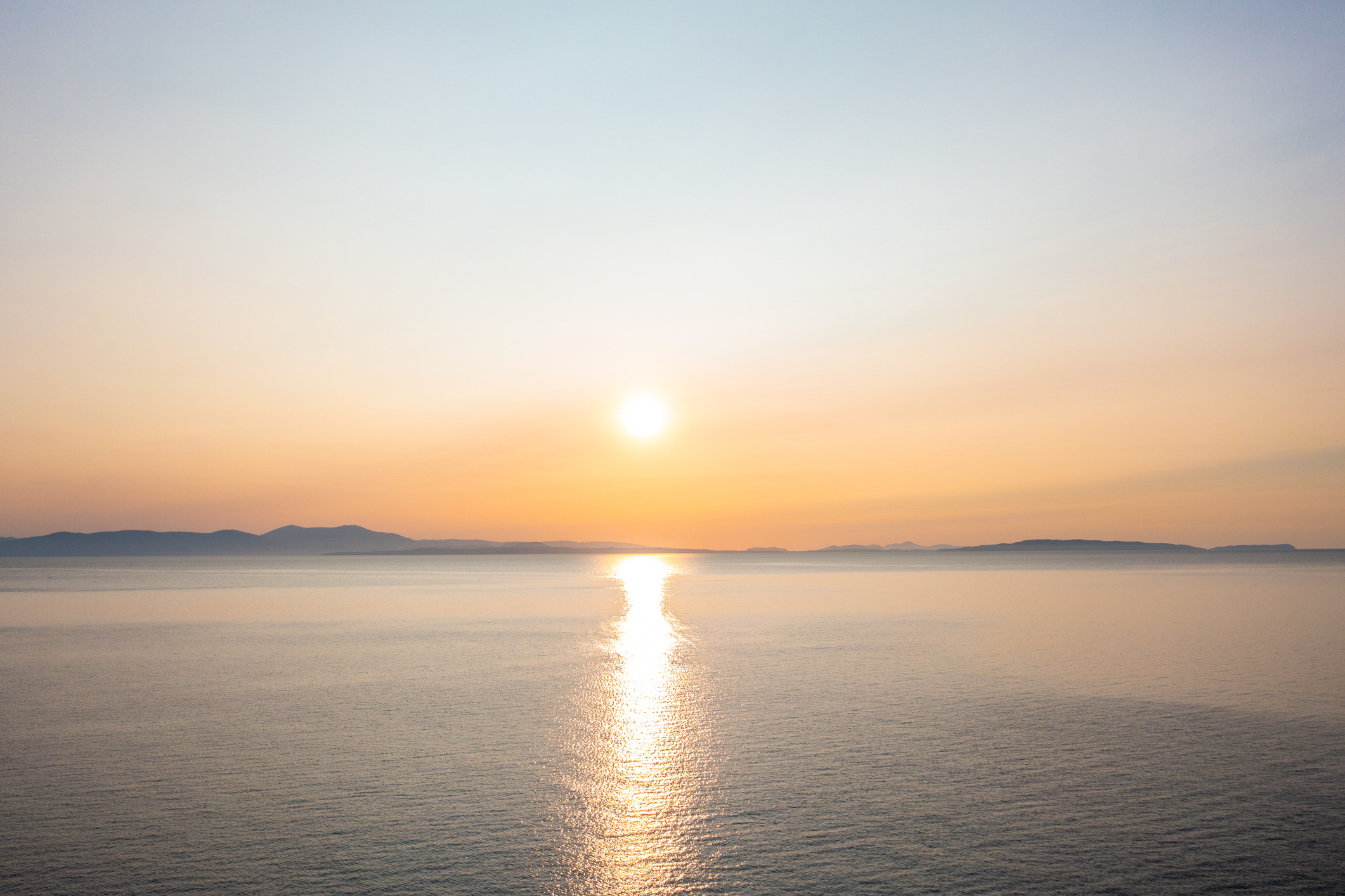
Most oceanic crust is less than 200 million-years-old, so when researchers announced in 2016 that they’d discovered an undisturbed section in the Mediterranean Sea, dating back roughly 340 million years, it came as a major surprise.
This ancient piece of oceanic crust is found in the Herodotus Basin, a deep-marine abyssal plain located in the far eastern Mediterranean, sandwiched between Cyprus and Crete to the north and Egypt to the south. It’s thought this crust may be a remnant of a prehistoric ocean known as the Tethys Sea, which existed long before the Atlantic and Indian Oceans.
The deepest parts of the Herodotus Basin exceed 3,000m and, as a result, are inhospitable to most forms of life, save for specialised worms, clams, and microbes that thrive in the harsh, high-pressure, low-oxygen environment.
However, the waters above the basin floor support a rich diversity of marine life, such as bottlenose dolphins, mako sharks, and even sperm whales. This part of the Mediterranean is also home to one of the world’s most endangered marine mammals, the Mediterranean monk seal. In 2015, its population was estimated at fewer than 700 individuals.
Namibia’s Cloudina Reef
Perched atop rolling hills in southern Namibia are many strange, bulbous boulders packed with thousands of fossils.
While this part of sub-Saharan Africa may be one of the driest places in the world today, 550 million years ago it lay beneath a shallow sea inhabited by enigmatic, reef-building creatures called Cloudina - the animals whose remains now make up these boulders.
The discovery of this massive fossil reef deposit was made in 2014 by a team of researchers led by the University of Edinburgh. Based on their observations, they were able to work out that Cloudina attached themselves to one another (and other surfaces) using calcium carbonate, the same cement used by modern corals. This process formed giant reefs that would have covered vast swathes of the ancient sea floor.
According to the researchers involved in this study, Cloudina were the first animals to build reefs and were doing so even before the evolution of complex animal life in the Cambrian Period, roughly 10 million years later.
Namib Desert
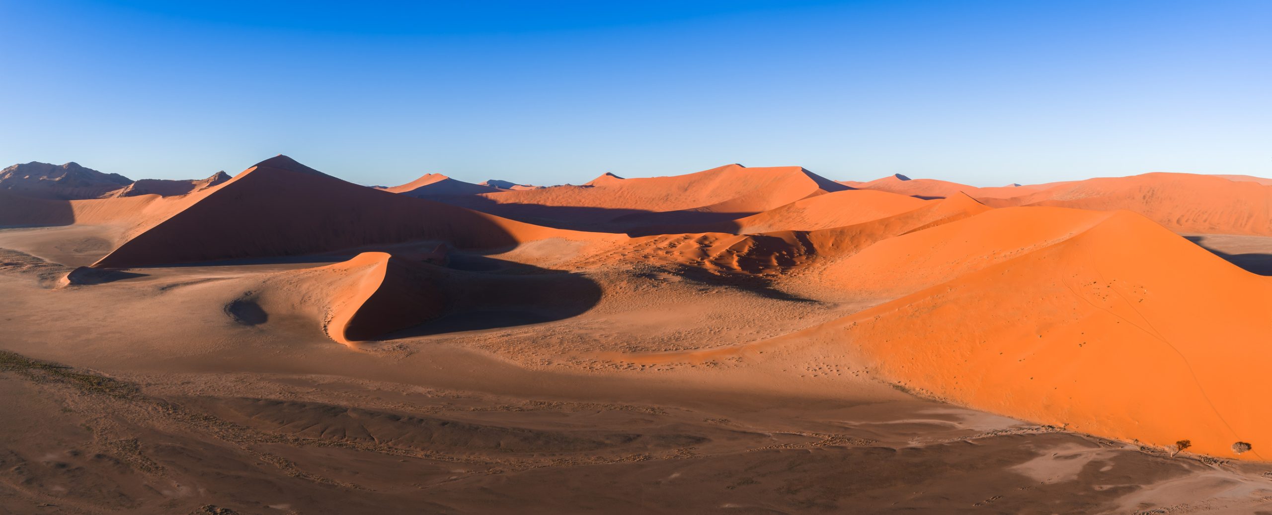
The Namib Desert in Southern Africa is widely considered the oldest desert in the world, having endured arid (or at least semi-arid) conditions for the last 80 million years.
However, the giant, migrating sand dunes that make up the iconic Namib Sand Sea are much younger. These sands were largely deposited by the Orange River and then blown inland in the last five million years. Nevertheless, this arid wilderness remains one of the most undisturbed landscapes on Earth and is home to several endemic and highly adapted species.
- Researchers went into the oldest desert on Earth and discovered something "really unique" about the way beetles run
- 10 desert plants that thrive in hostile and inhospitable conditions – often in extreme temperatures
The Welwitschia plant is just one example, famous for its ability to capture moisture from coastal sea fogs and live for more than a thousand years. Some individual plants are thought to be nearly 2,000 years old!
The animals that live in the Namib Desert are similarly well adapted. The head-stander beetle stands on its forelegs during foggy weather and uses its back to capture water droplets that then run down into its mouth. This desert is also home to antelopes, desert elephants, and even lions, some of which have been documented hunting Cape fur seals along the remote Skeleton Coast.
Isua Greenstone Belt
In southwestern Greenland, near the territory’s capital Nuuk, lies a band of exposed rocks known as the Isua Greenstone Belt.
This ancient rock formation is made up of metamorphosed volcanic and sedimentary rocks that are believed to be between 3.85 and 3.6 billion years old. Due to its age, the belt has become a focus for investigations on the emergence of life, as well as the style of plate tectonics that operated during Earth’s early years.
In 2016, a team of researchers from Australia reported the discovery of structures in the Isua Greenstone Belt that they interpreted as fossilised microbial colonies. These structures, known as stromatolites, are layered formations created by communities of microorganisms, typically photosynthetic organisms such as cyanobacteria, and are some of the earliest forms of life on Earth. However, subsequent studies have challenged the interpretations of these researchers, raising doubts about whether the structures are truly biological in origin.
Today, southwestern Greenland’s relatively mild climate supports a rich array of Arctic wildlife, from caribou and Arctic foxes to thousands of migrating seabirds.
Daintree Rainforest
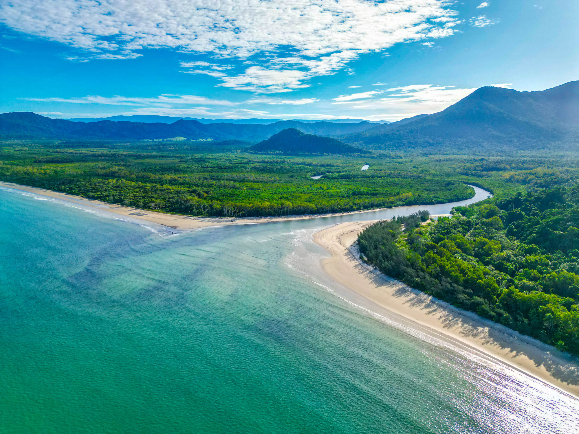
At around 180 million years old, Daintree rainforest on the northeastern coast of Queensland, Australia, is more than 100 million years older than South America’s Amazon rainforest. This makes it one of the most continuous landscapes on Earth and older even than most of the dinosaurs we know and love, such as T.rex, Triceratops, and Stegosaurus.
This rainforest measures roughly 1,200 square kilometres and is home to approximately 3,000 different plant species. It also contains 30% of the total frog, reptile, and marsupial species in Australia, and 90% of the continent’s bat and butterfly species.
- How do animals near the equator survive the tropics? The ingenious survival tactics rainforest creatures use, including homemade sunscreen.
- What's the largest forest in the world?
Although it supports a large proportion of Australia’s biodiversity, it represents only a small remnant of a once-vast forest that covered much of the continent.
Over the past 120 million years, shifting climatic conditions driven by continental drift have dramatically reduced its extent, leaving the original forest confined to refugial areas along the east coast.
Hamersley Range
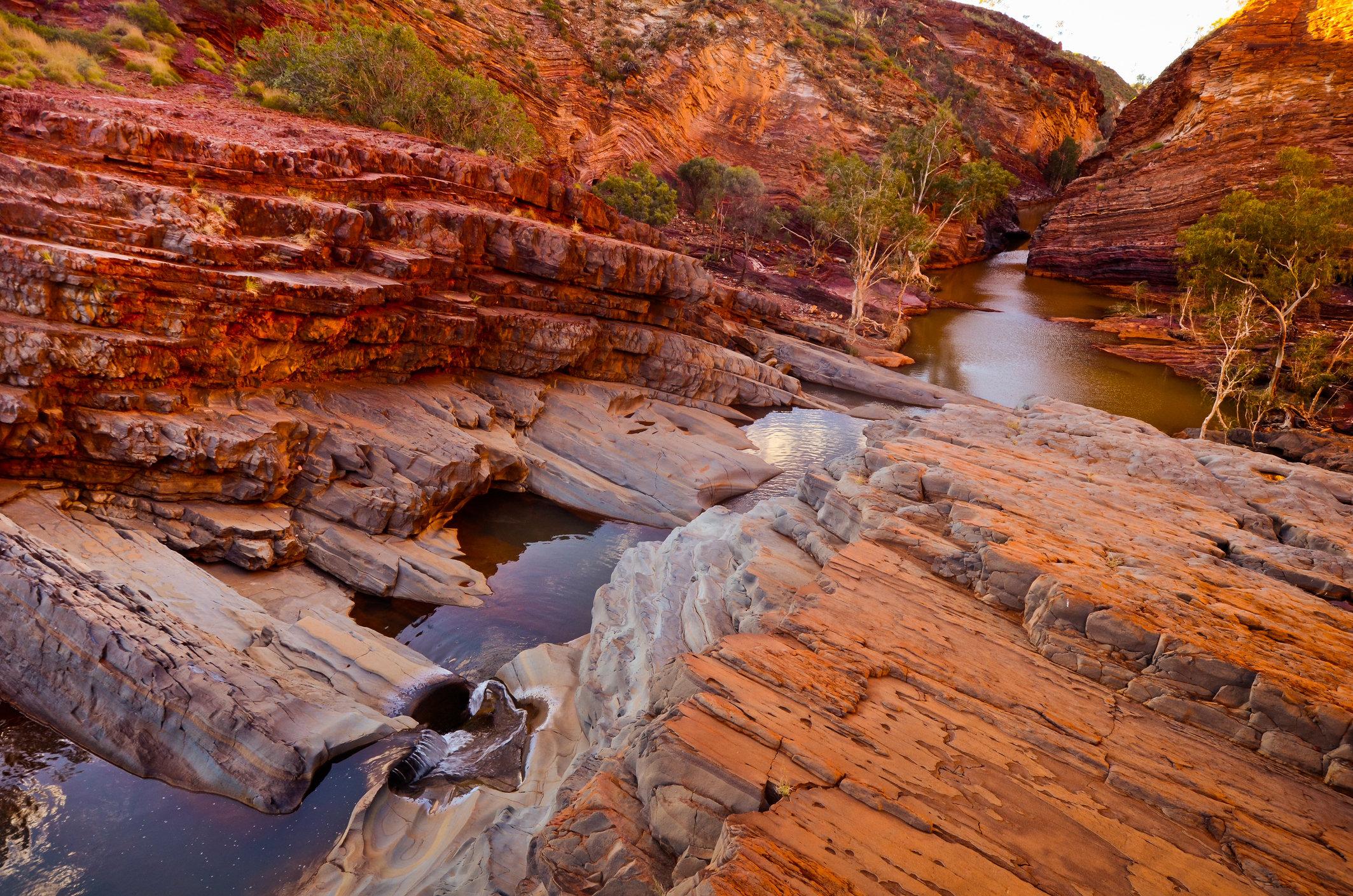
Also located in Australia, the Hamersley Range is a series of mountains composed of banded iron formations that date back 2.5 billion years.
Situated in Western Australia, this range encompasses the stunning Karijini National Park, renowned for its dramatic gorges, cascading waterfalls, and pristine natural pools that attract visitors from around the world.
In addition to attracting tourists, the national park and surrounding Hamersley Range has long been a major centre for mining. For much of the past century, the region has been exploited for its vast iron ore deposits, which make up a large proportion of Australia’s iron ore exports. Mining in the area began in the 1930s with the extraction of blue asbestos, but operations shifted to iron ore in 1966 after growing awareness of asbestos’ associated health risks.
- 1.6 million years ago, a bird flew over this mountain range in Haiti. It helped create a plant wonderland
- In the 1970s, scientists noticed that trees in a US mountain range were migrating. Now they know why
The Hamersley Range has a mostly tropical to semi-arid climate that supports a rich diversity of marsupials, including red kangaroos, common wallaroos, and rock-wallabies. Several rarer marsupials have also been spotted in the region, such as the northern quoll (also known as the northern native cat) and the mouse-like Pilbara ningaui.
Acasta Gneiss Complex
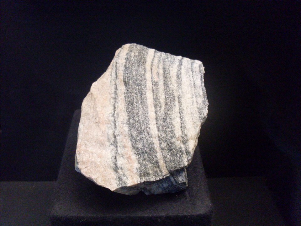
This rugged outcrop of metamorphic bedrock in the Northwest Territories of Canada is almost as old as the Earth itself, yet it lies at the heart of a habitat that supports a rich diversity of animals, from polar bears, grizzly bears, wolves, and musk ox, to bald eagles, Canada geese, and ptarmigans.
The rocks that make up the Acasta Gneiss Complex are widely considered to be the oldest rocks in the world - a 2019 study used zircon dating to estimate they may date back as far as 4.03 billion years ago!
Not only are these rocks incredibly old, they’re also exceptionally rare. If you add up the area where they’re exposed at the surface, the total area would be only about 800 square metres, which is roughly the size of four tennis courts.
At the time the Acasta Gneiss Complex was formed, Earth’s surface looked very different and was completely devoid of life. It wasn’t until millions of years later that the first signs of life appeared, and another 3.2 billion years before the first animals evolved.
- The same size as Casablanca, this arid landscape holds over 15 staggering 300m rock towers older than the dinosaurs – and America’s deadliest snake
- It’s made up of 1,000 miles of tunnels and was once thought to be the gateway to the underworld – but remains largely unexplored
Top image credit: Orla/Getty Images


